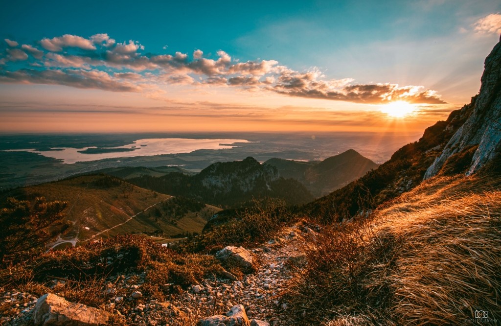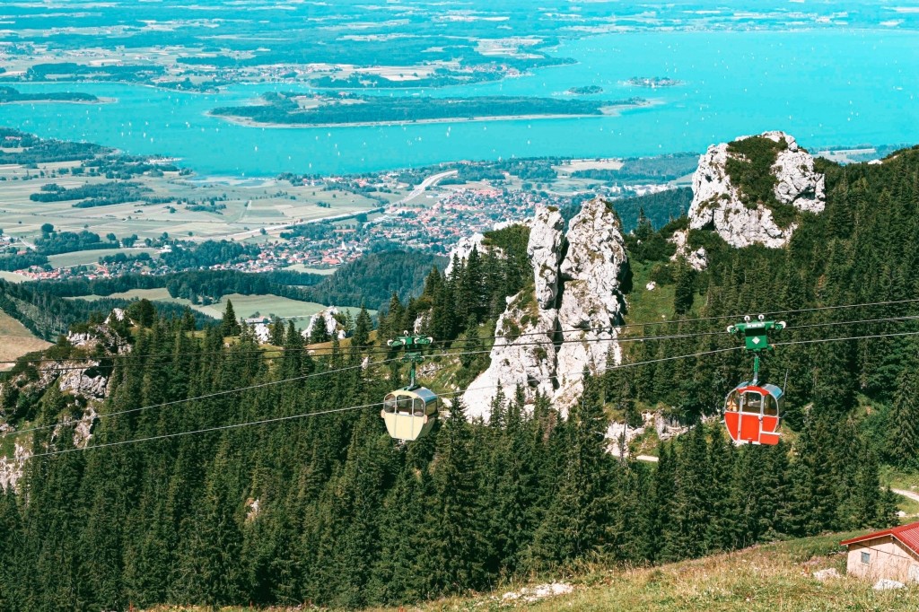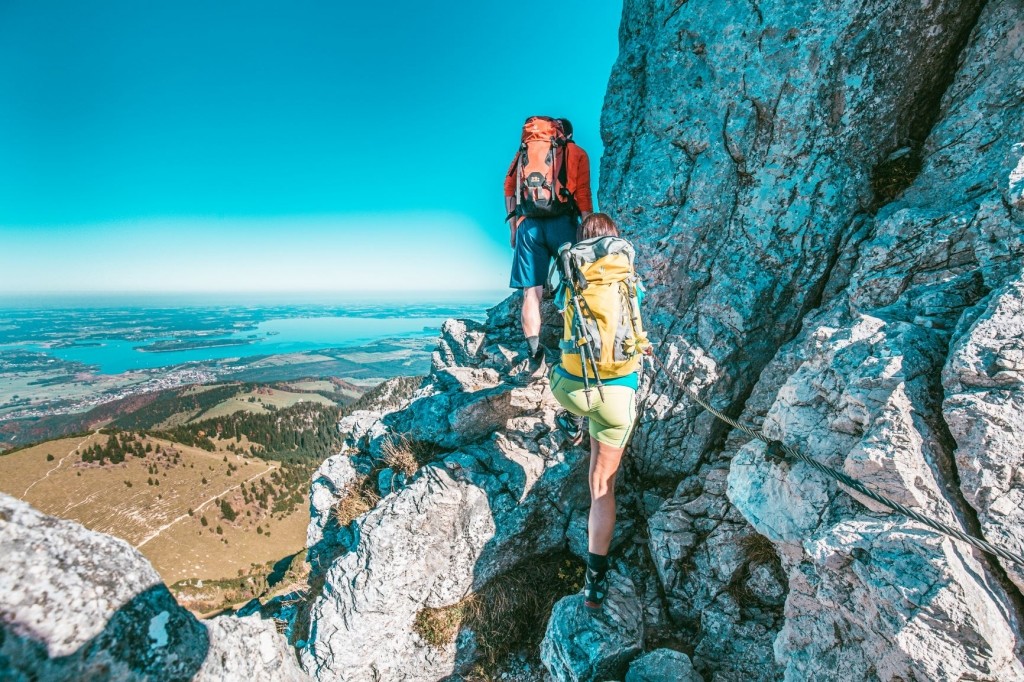


HIKING
Experience the mountains
Hiking
IN THE BAVARIAN ALPS
Experience the Bavarian Alps and hike through untouched nature. Peace & vitality – simply do you good! The alpine landscape never fails to impress with fascinating moments.
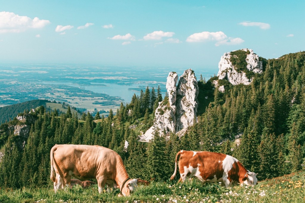
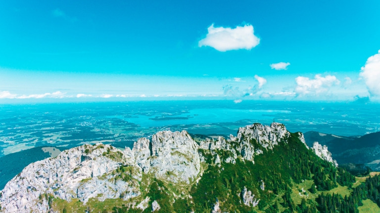
The imposing summit scenery that inspires hiking tours in the Southern Alps seems almost close enough to touch. From the nearby Chiemgau and Mangfallgebirge mountains to the Berchtesgadener Land and the Alpine crossing to the Austrian Alps, nature and mountain lovers are inspired time and time again.
Challenging high mountain tours or relaxed alpine hikes: the scenery could hardly be more beautiful! Dense forests, thundering waterfalls and mystical mountain lakes. At every altitude, you will come across natural sites full of magic and beauty when hiking in the Bavarian Begwelt. The rustic mountain inns with breathtaking panoramic views of forests and lakes provide typical Bavarian specialties.
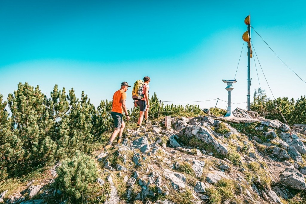
MOUNTAIN TOURS
AND LODGE HIKES
We have combined the most beautiful mountain tours for you in our hiking booklet.
For hikes with the whole family, we recommend the shorter lodge hikes that are possible in summer and winter.
All tours have been put together with love by us and we have of course also hiked all of them.
Chiemgau Alps
Ascent: 2:45 hours
Descent: 2:00 hours
Altitude difference 1049
Parking lot Aschau/Kohlstatt (650 m) – Steinlingalm (1473 m) – Kampenwand (1669 m)
Character: Easy mountain hike to the Steinlingalm, increasingly steep and stony ascent to the summit
The Kampenwand – our local mountain
The Kampenwand is the most famous peak in Chiemgau. First we head towards the Maisalm. This small, enchanting alpine pasture is also recommended for short family hikes.
Continue towards the Steinlingalm and on to the Kampenwand.
Continue towards the Steinlingalm and on to the Kampenwand.
The forest slowly thins out and the path gradually leads to the saddle between Gedererwand and Sulten. The Steinlingalm is soon reached.
Behind the lodge, a steeper path now leads to the rocky summit region – which can then only be mastered with easy scrambling.
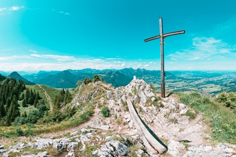
After circling the last rock with the help of a wire rope, only a small bridge separates you from the huge summit cross, which honors the fallen of the Chiemgau.
Enjoy the wonderful view over the Chiemgau and the Chiemsee.
Directions: Country road towards Aschau im Chiemgau / in Aschau at the traffic circle turn right towards Sachrang / after the Gassner country butcher’s shop turn right into Aufhamer Straße / towards the Kohlstatt hiking parking lot
Costs: Parking lot Kohlstatt 2,- € day ticket (as of 2021)
Chiemgau Alps
Ascent: 2:15 hours
Descent: 1:50 hours
Altitude 675 meters
Steinbergalm (1000 m) – Bründlingalm (1167 m) – Hochfelln (1674 m)
Character: Moderately difficult mountain hike, above the Bründlingalm the path turns into a partly stony and steep path.
Hochfelln – the popular one
The quickest way to reach the summit is via the Steinbergalm. You walk up the forest path until you reach a pasture gate. You continue along a moderately steeper path through the forest until you reach a crossroads. You walk towards Hochfelln, accompanied by the course of the Schwarze Ache stream.
The first refreshment stop is the Bachschmiedkaser Alm (1130 m), a little above the lodge you reach the Öderkaser Alm (1161 m) and shortly afterwards the Bründlingalm (1167 m).
A path with steps leads you steeply uphill through the forest. You will soon reach two hairpin bends, where you have to slip between two rocks. A winding path continues in the direction of the Hochfellnbahn mountain station.
Our tip: On the descent, you will pass the middle station. There you can stop at the Hochfellnblick panoramic restaurant. You can purchase a voucher for a hearty snack at our reception.
Directions: A8 towards Salzburg / exit Siegsdorf / towards Inzell/Ruhpolding / at the entrance to Ruhpolding turn right at the Aral petrol station into Maiergschwendter Straße and after 1.1 kilometers turn right at the fork in the road towards Steinbergalm
Costs: Parking lot Steinbergalm 2,- € (as of 2021)
Chiemgau Alps
Ascent: 2:30 hours
Descent: 1:45 hours
Altitude difference 860m
Route 8.4 kilometers
Sachrang (772 m) – Spitzsteinhaus (1252 m) – Altkaseralm (1279 m) – Spitzstein (1596 m)
Character: up towards the Spitzsteinhaus it is an easy hike. After that, rugged and steep paths await you. Sure-footedness is an advantage before the summit ascent.
Spitzstein – the classic
The hike up the Spitzstein (1596m) is a classic in the west of Chiemgau, which can be reached at almost any time of year thanks to the Spitzsteinhaus (1252m).
From the hiking parking lot, the trail leads towards the Spitzsteinhaus. You now hike steeply uphill through dense mountain forest and leave the forest after a few minutes. The path continues across a meadow towards the hamlet of Mitterleiten.
The path continues along a wide track until you reach a tarred road to Mitterleiten. In Mitterleiten, we turn left immediately after a farm and then turn diagonally right onto a wide path.
We hike downhill, following a wooden fence, losing a good 20 meters in altitude. At afork in the path, we follow the signs for Spitzstein, Spitzsteinhaus and walk back across a meadow.
Continuing through a dense mountain forest again, you gain altitude. After about 30 minutes you reach the Steinmoosalm. Then head towards the Spitzsteinhaus, which is already visible, and finally climb up several hairpin bends to the shelter of the German Alpine Club (1252 m) (1 ½ hours from Sachrang).
Pass the terrace of the Spitzsteinhaus on the right and hike up a steep path to the Altkaseralm (1279 m) in two minutes. From there you can reach the summit within 1 hour. The path becomes steep and rugged and you then always follow the red dot markings.
To the north, you can see the neighboring Chiemgau mountains of Hochries and Kampenwand, and to the west, the Wendelstein and the Bavarian Pre-Alps.
Directions: A8 towards Munich / exit Frasdorf / towards Aschau im Chiemgau / towards Sachrang / in Sachrang towards Spitzstein hiking parking lot
Costs: Sachrang parking lot 2,- € (as of 2021)
Chiemgau Alps
Ascent: 2:30 hours
Descent: 1:30 hours
Altitude difference 890
Spatenau hiking parking lot (800 m) – Seitenalmen (1330 m) – Hochries (1569 m)
Character: Easy hike to the Doaglalm, further on to the Seitenalmen it becomes steeper and steeper and stony ascent to the summit
The Hochries – the pre-Alpine summit with a 360-degree view
Many roads lead to the Hochries! But we present our favorite tour: From the Spatenau hiking parking lot, head towards the Doaglalm. From there you can choose between two routes. Take the forest path on the right or the forest path on the left. You can walk both routes to the Doaglalm junction in around 35 minutes. The Doaglalm is then on the right, but you continue straight ahead towards Hochries. This is followed by a moderate ascent with many steps up to the Seitenalmen. Enjoy the wonderful view down into the valley!
At the next junction, keep left towards Hochries. The steep and partly stony ascent takes about 45 minutes to the summit. Once you reach the summit, the Hochrieshütte awaits you with an all-round view of the Bavarian Alps!
The Hochrieshütte is not only an inviting place to stop for a bite to eat and linger, but is also an integral part of the paragliding scene. More information at https://www.flugschule-hochries.de/
If you would like to continue your hike, you can hike from the Hochries summit towards Karkopf 1496m (30 min) and on to Feichteck 1514m (30 min). However, the ridge is narrow and more challenging. Climbing passages require surefootedness. From Feichteck you descend directly to the Doaglalm.
Directions: A8 towards Munich / exit Frasdorf / towards Achenmühle / in Achenmühle turn left towards Samerberg – Törwang / then towards Grainbach / through Grainbach to the turn-off towards Doaglalm, Duftbräu / towards Spatenau
Costs: Spatenau parking lot 3,- € day ticket (as of 2021)
Chiemgau Alps
Ascent: 2:15 hours
Descent: 1:45 hours
vertical meters 880
Distance 12 kilometers
Windshausen (480 m) – Kranzhornalm (1230 m) – Kranzhorn summit (1368 m)
Character: A long mountain hike with a moderate ascent to the Kranzhornalm. The summit can be climbed with a wire rope. Surefootedness and a head for heights required.
Kranzhorn – the panoramic experience
The Kranzhorn is a popular panoramic mountain in the Chiemgau Alps. From the Windshausen parking lot, follow the wide forest path. After about 25 minutes, turn right onto a signposted forest path, which rejoins the forest path a little later. A little later you will come to a signposted turn-off to Heuberg.
However, keep in the direction of Kranzhorn until later, when the path becomes steeper and turns off to the right (“Kranzhorn, footpath”) – alternatively, the path is somewhat flatter and continues straight ahead for longer. Depending on the path you choose, follow it to the Kranzhornalm. Once you reach the Kranzhornalm, you have a fantastic view of the Hochries, Spitzstein and Heuberg.
The Kranzhornalm is perfect for families. To continue the hike, turn right past the Kranzhornalm. You reach a small pre-cross which already offers a great view. You continue along the moderately ascending, stony path and reach the summit with the small chapel slightly below about 20 minutes after the alpine pasture. The small summit rises above the Inn Valley and marks the border between Tyrol and Bavaria. Two summit crosses, one Bavarian and one Tyrolean, adorn the highest point. Now you have a view as far as the Zillertal Alps.
The Kranzhorn is also a hot tip for mountain bikers! The official MTB route Windshausen/Nußdorf ends at the Kranzhornalm. However, it should be noted that the summit and the alpine pasture area around the hut are expressly prohibited for biking.
NEW: Free e-bike charging station for lodge guests
Directions: A8 towards Munich / direction Inntal Dreieck / exit Brannenburg / towards Nussdorf / then towards Erl / via Sonnhart to Windshausen / at the end of Windshausen turn left (very small sign) / cross a small bridge to the hikers’ parking lot
Costs: Windshausen parking lot free of charge (as of 2021)
GEIGELSTEIN
Chiemgau Alps
Ascent: 3 hours
Descent: 2 ½ hours
Altitude difference 1115m
Route 14 kilometers
Huben (716 m) – Jägersteig – Schreckalm (1403 m) – Sulzingalm (1494 m) – Geigelstein (1808 m)
Character: average fitness is an advantage. Several forest and meadow paths, partly stony and steep.
Geigelstein – the beautiful one
The Geigelstein is the highest mountain in the western Chiemgau Alps and perhaps the most beautiful panoramic peak in Chiemgau. It is not without good reason that the Geigelstein is also known as the flower mountain. In spring, veritable carpets of mountain flowers line its grassy slopes. From Huben, you hike up a fairly steep forest path until you reach the ascent path from Sachrang at a lodge. Now follow the signpost “Schachenalm and Geigelstein via Schreckalm” and continue to another forest path. Keep left here and shortly afterwards turn sharp right towards “Geigelstein, Priener Hütte”. The route now climbs steeply through the woods. Follow the signs for “Jägersteig”. You soon come to a meadow area over which you hike to the Schreckalm. You now walk along the mountain range and have a wonderful mountain panorama.
Continue in the direction of Geigelstein and walk along a meadow path towards a wooden hut. Shortly before the wooden hut, take the meadow path uphill in an easterly direction. The Geigelstein soon appears in front of you. To the left of the Geigelstein is the Rossalpenkopf. Continue to the Sulzingalm and turn right along the forest path down to a large crossroads. For the direct ascent to the Geigelstein, take the left-hand path and follow the forest path to the Oberkaseralm. At the Oberkaseralm, the trail to the Geigelstein summit begins on the left and takes about 25 minutes to reach the saddle. From the saddle, follow a stony path to the summit. At the summit, you can now enjoy an incredibly far-reaching view over the Chiemgau Alps, the Reiter Alm and the Loferer Steinberge to the Hohe Tauern. To the south, the Kaiser mountains can be seen in all their glory.
Our tip: Visit the Priener Hütte on your descent to the Oberkaseralm. Turn sharp left there and you will reach the Priener Hütte within ten minutes, passing the mountain rescue hut.
Directions: A8 towards Munich / exit Frasdorf / towards Aschau im Chiemgau / towards Sachrang / Before the village of Huben turn left into the parking lot Huben
Costs: Huben parking lot free of charge (as of 2021)
HEUBERG
Chiemgau Alps
Ascent: 1:30 hours
Descent: 1:15 hours
Altitude 560 meters
Route 6.8 kilometers
Heuberg parking lot (780 m) – Daffnerwaldalmen (1050 m) – Heuberg (1338 m)
Character: Easy mountain hike that leads to the Daffnerwaldalmen on a wide forest path. The route to the summit continues with an abrupt ascent into the dense forest.
The Heuberg – the family-friendly mountain
The Heuberg is a wonderful mountain experience for the whole family. Especially in spring, the purple and white crocus blossoms can be admired. From the Schweibern forest parking lot, the trail leads along a forest path through the dense forest. After about 30 minutes there is a fork. Both paths lead to the Heuberg summit within 1 hour walking time. The right fork leads through a forest path with a moderate ascent. The path is almost entirely in the forest, so in the shade, but with a great view towards Wendelstein.
The left fork first continues along the forest path until you reach the Daffneralmen. Past the Daffneralmen, turn right across the alpine meadows steeply up the mountain towards the Wasserwand. Until you reach the woods, you have a sunny ascent and a great panorama over the alpine meadows.
Once you reach the summit, you can enjoy a wonderful view. The water wall is available for the very motivated. The climb only takes 15 minutes with a climbing rope, but you should be free from giddiness and have climbing ambitions.
Our tip: Take a circular route. At the beginning, take the right-hand ascent through the forest and back down across the alpine meadows. Then you can stop off at the Daindlalm at the end of your hike. A magnificent view of the Samerberg, Simssee and the Kaiser mountains awaits you here. The Daindlalm is open daily from mid-May to mid-October.
Directions: A8 direction Munich / exit Frasdorf / direction Achenmühle / in Achenmühle turn left towards Samerberg – Törwang / then towards Grainbach / through Grainbach to the junction towards Doaglalm, Duftbräu / towards Spatenau / towards Duftbräu / after the Duftbräu turn left towards Schweibern
Costs: Schweibern parking lot free of charge (as of 2021)
FEICHTECK
Chiemgau Alps
Ascent: 2:15 hours
Descent: 1:30 hours
Altitude 714 meters
Route 8.6 kilometers
Spatenau hiking parking lot (800 m) – Doaglalm (980 m) – Feichteck (1514 m)
Character: Easy mountain hike only suitable for children up to Doaglam. To Feichteck it gets steeper and stonier, medium fitness is an advantage
Feichteck – the mysterious one
The route to Feichteck leads almost exclusively through the mysterious forests. From the Spatenau hiking parking lot, you first head towards the Doaglalm. From there you can choose between two routes. Take the forest path on the right or the forest path on the left. You can walk both routes to the Doaglalm junction in approx. 35 minutes. Directly at the Doaglalm, a path leads off to the right towards Feichteck. Now the ascent becomes increasingly steeper and is rather stony through the woods. After about 30 minutes of walking you will reach a sign marked Drexlhaus. However, you continue straight on to the Sachrinnstein hunting lodge, where you can catch your first panoramic view.
Further up the mountain there is a sign for Ewaldweg. However, turn right up to the Feichteck summit. The path becomes more and more challenging as you ascend. At the saddle between Feichteck and Karkopf, the destination is reached in approx. 20 minutes. Only suitable for experienced mountaineers in winter and icy conditions.
If you would like to continue your hike, you can hike from the Feichteck summit towards Karkopf 1496m (30 min) and on again to Hochries 1569m (30 min).
Our insider tip: If you are planning a longer day trip and enjoy hiking through the woods, take the Ewaldweg turn-off! The Ewaldweg is a very narrow forest path with few but intense climbs. You can only reach the Albert Drexlhaus with a unique view down into the valley via the Ewaldweg. The “indicated” forest path leads to the side pastures below the Hochries summit.
Directions: A8 towards Munich / exit Frasdorf / towards Achenmühle / in Achenmühle turn left towards Samerberg – Törwang / then towards Grainbach / through Grainbach to the turn-off towards Doaglalm, Duftbräu / towards Spatenau
Costs: Spatenau parking lot 3,- € day ticket (as of 2021)
LAUBENSTEIN
Chiemgau Alps
Ascent: 2 hours
Descent: 1:30 hours
Altitude 700 meters
Distance 8.6 kilometers
Hikers’ parking lot Lederstube (800 m) – Laubenstein (1351 m)
Character: Easy mountain hike on the forest road, through the woods and the last ascent steep and stony
Laubenstein – the insider tip
The path to the Laubenstein is a real insider tip! You have a wonderful panoramic view of Lake Chiemsee and Lake Simsee. From the Lederstube hikers’ parking lot, head towards Frasdorfer Hütte. Now walk uphill for about 30 minutes; leave the shortcut to the Frasdorfer Hütte on the left and stay on the forest path. Then you will find a triple fork in a left-hand bend over the stream. Now take the middle, small mountain path towards Hochries and Riesenhütte. The bumpy path leads uphill for about 15 minutes to a forge chapel.
Continue straight ahead across the alpine meadows until you reach an alpine cross. Continue in the direction of Hochries and Riesenhütte. The trail now runs through a narrow forest path towards Hochries. Continue through the forest until you reach a multiple junction. Here the direction Laubenstein is indicated. After approx. 200m, take the left-hand path to Laubenstein at the fork and hike along the wide and steep path to Laubensteingatterl (1273m).
Continue to the Laubensteinalmen. There is no catering and they only serve drinks. Directly after the lodge, you reach the wide summit hump across the alpine meadow. After a few steps, you will see the beautiful summit cross and a fantastic panoramic view of the Chiemsee and the Simsee. On the descent, we recommend that you head towards the Frasdorfer Hütte. The newly renovated hut invites you to stop for a bite to eat. It is closed on Mondays and Tuesdays. From the Frasdorfer Hütte, the way back to the parking lot is exclusively via the forest path, approx. 45 minutes descent.
Our insider tip: If you are planning a longer day tour, you can climb the Hochries 1569m from the Laubenstein in approx. 1 ½ hours and the Predigtstuhl in approx. 1 hour. To do this, you have to hike along the ice cellar at the Laubensteingatterl. Everything is very well signposted. Both hikes are quiet and secluded in the forest. However, when there is a lot of snow, they can only be tackled with snowshoes.
Directions: A8 towards Munich / exit Frasdorf / towards Lederstube or Frasdorfer Hütte
Costs: Parking lot Lederstube 2,- € day ticket (as of 2021)
GROSSER RIESENKOPF
Mangfall Mountains
Ascent: 2:30 hours
Descent: 2 hours
Altitude 850 meters
Route 12.2 kilometers
Flintsbach Falkenstein (485 m) – Hohe Asten (1104 m) – Riesenkopfalm (1176 m) – Großer Riesenkopf (1337 m)
Character: Easy mountain hike to the Riesenkopfalm, then steeper to the summit
Großer Riesenkopf – the Inn Valley
The Riesenkopf is particularly popular because of the Hohe Asten – the highest farmed mountain farm in Germany. From the hiking parking lot, you pass Falkenstein Castle and ascend quickly. After 45 minutes you reach a flat and non-forested area. On the right-hand side you will now see the Maiwand with its striking rock spire.
The path becomes a little steeper again and leads directly into the forest. After 1 ½ hours of walking, you will come to a fork in the path and head straight on to the Hohe Asten. If you turn right, you will reach the Riesenkopfalm within 30 minutes, from where you can begin your ascent to the summit.
Shortly before the Hohe Asten, the path to the Riesenkopf branches off to the right (green signpost). The path continues over a grassy slope until it leads off to the right. Slowly follow the Riesenkopfalm past which you pass on the right, always heading towards the Großer Riesenkopf. Follow a steep path through the mountain forest. Shortly before leaving the forest, the summit cross of the Großer Riesenkopf shimmers through the trees. Once you reach the summit, you can enjoy the view of the Chiemgau peaks such as the Heuberg, Spitzstein, Kranzhorn, the Kaiser Mountains and the Loferer Steinberge, as well as the foothills of the Alps such as the Wendelstein and the Hochsalwand.
Our tip: A stop at the Hohe Asten is a must! The working mountain farm will treat you to delicacies from its own production.
Directions: A8 towards Munich / towards Inntal Dreieck / exit Brannenburg / towards Flintsbach-Kiefersfelden / in Flintsbach to Falkenstein Castle / Falkenstein hiking parking lot
Costs: Falkenstein parking lot free of charge (as of 2021)
HOCHRIES – 1569M – ALTERNATIVE TOUR
Chiemgau Alps
Ascent: 3 hours
Descent: 1 hour
Vertical meters 900
Route 15.6 kilometers
Lederstube hiking parking lot (800 m) – Riesenhütte (1346 m) – Hochries (1569 m)
Character: Easy hike that leads to the summit of the Hochries over moderately steep slopes and wide paths. The ascent over the Hochries summit slope is somewhat steeper. On the way back from the Riesenalmen to the Riesenhütte, there is a short ascent in the opposite direction.
The Hochries – the pre-alpine summit with a 360-degree view
From the Lederstube hikers’ parking lot, head towards Frasdorfer Hütte. After about 30 minutes up the forest path, you come to a left-hand bend with a triple junction. Now take the middle, small mountain path towards Hochries and Riesenhütte. The path leads uphill for approx. 15 minutes to a forge chapel. Continue straight ahead across the alpine meadows until you reach an alpine cross. Continue in the direction of Hochries and Riesenhütte. The path now runs through a narrow forest path towards Hochries. Continue through the forest until you reach a multiple junction and continue in the direction of Riesenhütte/Hochries.
After a further ten minutes’ walk, the small path joins the wide road, which you now follow for the next 30 minutes. Continue uphill in the direction of the Riesenhütte. Finally, you reach a large clearing and pass the summit of the Spielberg. After a total walking time of 2 ¼ hours, you have arrived at the Riesenhütte. Continue towards Hochries, which you can now already see in all its glory. At the saddle, turn left and hike towards the summit slope. You climb steeply up the summit slope in many serpentines through a wide aisle.
After a 3-hour walk, you will finally reach the Hochrieshütte. To the left of the lodge is the Hochries summit cross. Before enjoying a well-earned break, we enjoy the far-reaching views over the Chiemgau Alps and the Kaiser Mountains to the Hohe Tauern.
Our tip: On the way back, you can take a short detour to the Frasdorfer Hütte. There you have a wonderful place to stop for a drink.
Directions: A8 towards Munich / exit Frasdorf / towards Lederstube or Frasdorfer Hütte
Costs: Parking lot Lederstube 2,- € day ticket (as of 2021)
FRASDORFER
Chiemgau Alps
Ascent: 1 hour
Hikers’ parking lot Lederstube (800 m) – Frasdorferhütte (950 m)
Character: Easy mountain hike for the whole family
The Frasdorferhütte
Our hut tip for the whole year – a wonderful excursion for the whole family. In summer you can enjoy the wonderful sun terrace and in winter you can expect a full winter sports program. Whether tobogganing, snowshoeing or ski touring, everything is possible here and within easy reach. From the Lederstube hikers’ parking lot, the trail always leads towards Frasdorfer Hütte. The wide forest path is easy to manage and runs through the forest past small streams. Shortcuts are occasionally possible over roots and stones. You can reach the Frasdorfer Hütte in approx. 1 hour.
The lodge was completely renovated in February 2021.
Monday and Tuesday are closed.
Our tip: After the Frasdorfer Hütte, take a short detour to the Hofalm. This can be easily reached in 20 minutes from the Frasdorfer Hütte. You just walk across the alpine meadows. Once there, fresh Hofalm milk and homemade cakes and pastries await you. The Hofalm is closed on Thursdays.
Directions: A8 towards Munich / exit Frasdorf / towards Lederstube or Frasdorfer Hütte
Costs: Parking lot Lederstube 2,- € day ticket (as of 2021)
HEFTERALM
Chiemgau Alps
Ascent: 40 minutes
Hiking parking lot Strehtrumpf (690m) – Hefteralm (1,020m)
Character: Easy hike for the whole family
Hefteralm – Grassauer Alm
Thanks to the well-maintained paths, which are signposted and marked and lead through flat or gently sloping terrain, this trail is suitable for everyone. There is no danger of falling and orientation is easy. After about 30 minutes, you can take a short break on a bench on the right-hand side and enjoy the fantastic view of the Chiemsee. After another 10 minutes or so (the last ascent is a little steep), we reach the Hefteralm through a small gate. The famous mini-ponies are already coming towards us, and you may get the chance to pet some of them.
Children in particular feel at home here, as many animals spend the summer here, such as cows, horses, chickens, goats, rabbits and especially mini ponies.
The lovely surroundings and the warmth of the hosts are striking.
The Hefteralm is open from the beginning of May to mid-October, closed on Mondays from 3 pm.
For the rest of the hike: A narrow path leads to a flat saddle. After about 15 minutes you will see the Rachlalm (920m) behind it. From here, two somewhat steeper paths (approx. 25 minutes) lead up to the well-known Staffnalm (1,040m).
Directions: A8 towards Munich / exit Bernau am Chiemsee / towards Bernau / follow the road straight ahead through the village Rottau to Grassau / in Grassau after the car dealer Peugeot keep left in a right turn into the district Kucheln / towards the old mountain bath the road goes up / drive through the road to the end and you will reach the parking lot Strehtrumpf after about 5 minutes
Costs: Strehtrumpf parking lot cost can be determined by yourself (as of 2021)
KÄSERALM
Chiemgau Alps
Ascent: 30 minutes – 45 minutes
Parking lot Hochriesbahn (700m) – Käseralm (920m)
Character: Easy hike for the whole family
Käser Alm – The family hut
The Käser Alm is an ideal excursion destination for the whole family. For the little ones, it offers a spacious adventure playground with plenty of opportunity to let off steam.
The easiest way to reach the Alm is from the Hochriesbahn parking lot. The ascent is via a paved road along beautiful meadows and fantastic views of the surrounding mountain landscape. It is perfectly manageable for families with baby carriages. Shortly before the Alm, we pass below the middle station of the cable car, take a small right turn and we have our destination right in front of us.
We can then stretch our legs on the sun terrace on the mountain pasture and let our gaze wander over the Hochries, the meadows and grazing horses.
The Alm is open from May to the end of October from 10:00 am to 6:00 pm on Sundays and public holidays and is closed on Mondays. Until the end of August, it offers a campfire with music and barbecue every Wednesday evening in good weather. From mid-September to mid-October there is the “Musicians’ Autumn”.
Here you will find typical alpine delicacies and of course everything to do with cheese, such as cheese dumplings, cheese platter, Kaiserschmarrn and much more.
For summit lovers: The Hochries (1,569m) can be reached from here in approx. 2 hours. The path is well signposted. But you can also take various other routes from here, such as through forests and streams to the herb meadow or to the Schwarzsee, a nature reserve and legacy of the last ice age.
Directions: A8 towards Munich / exit Frasdorf / towards Achenmühle / in Achenmühle turn left direction Samerberg – Törwang / then towards Grainbach / drive through Grainbach until you see the cable car with the parking lot on the left side
Costs: Parking lot € 3,00 (as of 2021)
MAISALM
Chiemgau Alps
Ascent: 45 hours
Hiking parking lot Kohlstatt (650 m) – Maisalm (905)
Character: Easy mountain hike for the whole family
The Maisalm – small and fine
There are several ways to reach the Maisalm. In summer, the Kohlstatt trail is suitable and in winter the Aigen parking lot is ideal for tobogganing. You can hike from the Kohlstatt parking lot to the Maisalm in just 45 minutes. The route always follows a forest path. A beautiful stream can be seen right next to it. As soon as you reach the clearing, the Maisalm is on your left.
The Maisalm is a popular hiking destination for young and old in the middle of the Kampenwand. Enjoy the hearty alpine sandwiches with a shandy on the sun terrace.
Our tip: If you would like to continue your hike, why not climb the Erlbergkopf (1134m) in another 50 minutes?
Maisalm:
April to the end of October, closed on Mondays
November to March, closed Monday to Thursday
Directions: A8 towards Munich / exit Frasdorf / towards Aschau im Chiemgau / in Aschau turn right at the traffic circle towards Sachrang / after the Gassner butcher’s shop turn right into Aufhamer Straße / towards the Kohlstatt hiking parking lot
Costs: Parking lot Kohlstatt 2,- € day ticket (as of 2021)
PRIENER HÜTTE
Chiemgau Alps
Ascent: 1 ½ hours
Hiking parking lot Huben (700 m) – Priener Hütte (1410)
Character: the easy hike for families
Priener Hut
The Priener Hütte in the Chiemgau Alps is open all year round. The hike along the forest road is suitable for the whole family.
From Huben, you hike up a steep section until you reach the ascent path from Sachrang at a hut. The route now continues moderately along the forest path. Some sections become a little steeper, but are still easy to manage.
If you find the forest path a little too boring, you can take the Grünbodensteig junction halfway up. The path runs past small waterfalls up a stony and shady path.
Our tip: Visit the Sulzingalm. About 20 minutes from the Priener Hütte. A nice little circular route to finish off.
Directions: A8 towards Munich / exit Frasdorf / towards Aschau im Chiemgau / towards Sachrang / shortly before the village Huben turn left to the parking lot Huben
Costs: Huben parking lot free of charge (as of 2021)
HOHE ASTEN
Mangfall Mountains
Ascent: 1:30 hours
Flintsbach Falkenstein (485 m) – Hohe Asten (1104 m)
Character: Easy mountain hike
Hohe Asten
The Hohe Asten is the highest mountain farm in Germany and is farmed all year round. From the Hohe Asten you can enjoy a magnificent view over the Inntal valley to the peaks of the Chiemgau Alps, such as the Heuberg, Spitzstein and Kranzhorn.
The ascent from Flintsbach to the Hohe Asten is easy and leads along a wide forest path. The ascent from Flintsbach is along a wide forest path. There are a few steep sections along the way, but these are always short and always on the forest path. The summit destinations around the Hohe Asten are the Großer Riesenkopf and the Rehleitenkopf, which can both be reached in 45 minutes.
Hungry hikers are catered for with hot meals, various snacks, homemade cakes and desserts. Products from our own farm are used for the preparation. A variety of meat and cheese products can be purchased to take home.
Our tip: Especially on Tuesdays and Wednesdays there is always a lively atmosphere on the Hohe Asten.
Hohe Asten:
Thursdays and Fridays are closed days at the mountain inn
If Thursday falls on a public holiday, the mountain inn opens its doors
Directions: A8 direction Munich / direction Inntal Dreieck / exit Brannenburg / direction Flintsbach-Kiefersfelden / in Flintsbach to Falkenstein Castle / Falkenstein hiking parking lot
Costs: Falkenstein parking lot free of charge (as of 2021)
STAFFENALM
Chiemgau Alps
Ascent: 1 ¼ hours
Parking lot Hochplattenbahn (450 m) – Staffenalm (1050)
Character: Easy hike for the whole family
Staffenalm – a family experience
The Staffenalm is a popular excursion destination for the whole family. The Staffen mountain forest adventure trail is particularly recommended. There are 20 stations for your children to play and learn at along the 4-kilometre trail. However, you should plan 2 ½ hours for the adventure trail.
From the Hochplattenbahn parking lot, walk along a wide forest path towards Staffen-Alm. After about 20 minutes of walking, a narrower and steeper mountain path leads you uphill.
A little later you cross a few ditches until you reach the Hochplattenbahn mountain station. Continue straight on to the Staffen Alm
There is a large children’s playground and a hang-gliding launch site right next to the Alm.
Our tip: If you want to climb to the summit of the Hochplatte (1586m), don’t miss out on this experience. The ascent is easy, but surefootedness is required at the summit itself.
Staffenalm:
April to the end of October, open daily
November to March, closed on Monday and Tuesday
Directions: country road towards Bernau / towards Grassau / in Grassau towards Marquartstein / shortly after the end sign for Grassau towards Hochplattenbahn / Hochplattenbahn hiking parking lot
Costs: Parking lot Hochplattenbahn 2,- € day ticket (as of 2021)
DAFFNERWALD ALMEN
Chiemgau Alps
Ascent: 2 hours
Mountain inn Duftbräu (780 m) – Daffnerwald-Almen (1050 m)
Character: Easy mountain hike for the whole family
The Heuberg is a wonderful mountain experience for the whole family. Especially in spring, the purple and white crocus blossoms can be admired. From the Duftbräu mountain inn, walk downhill to the bridge. Pass the bridge on the right and admire the famous waterfalls. The trail continues straight ahead, ignoring any junctions or crossroads. After approx. 15 minutes you reach a large meadow with wonderful opportunities for children to play by the stream.
Then continue across the meadow and narrowly up through the forest to a clearing. Here you cross a forest road and walk a few meters straight downhill past a game feeding station.
With varying gradients, the route leads mainly through forest until a fork in the path. The path on the right soon leads over tree roots and through forest to an alpine meadow and across it to the Daffnerwald alpine pastures. The Daindlalm and Laglerhütte invite you to stop for a bite to eat.
Daindlalm:
Open daily from mid-May to mid-October
October to May closed on Mondays
Laglerhütte:
Mid-May to mid-October closed on Mondays
October to May Monday, Tuesday and Wednesday closed
Directions: A8 towards Munich / exit Frasdorf / towards Achenmühle / in Achenmühle turn left towards Samerberg – Törwang / then towards Grainbach / through Grainbach to the junction towards Doaglalm, Duftbräu / towards Spatenau / parking Duftbräu
Costs: Parking lot Duftbräu 3,-€ (as of 2021)
WAGNERALM
Chiemgau Alps
Ascent: 30 minutes
Hikers’ parking lot Gammern (870 m) – Wagneralm (1018 m)
Character: Easy and short mountain hike
Wagneralm – the lookout lodge
The Wagneralm is a popular destination if you don’t want to plan much time for a hike. Despite the short distance, you have a stunning view of the Alps.
The quickest way to reach the Alm is from the Gammern forest parking lot. The ascent over wide forest paths and the last few meters over a narrow meadow path takes half an hour.
The Alm is beautifully situated on an alpine meadow with a great sun terrace. From the terrace you can admire the impressive water wall, as well as the Heuberg with the Daffneralmen, Kitzstein and Kranzhorn.
The Wagneralm is open daily from May to October. In the months from November to April, the Alm is open from Friday to Sunday and on public holidays.
The Wagneralm serves typical alpine snacks as well as hot dishes and cakes. The lodge is particularly famous for its lard noodles.
Our tip: The local mountain of the Wagneralm, the Feichteck (1514 m), can be reached from the hut within 1 ½ hours. The path up to the Feichteck is well signposted. If you choose the red marked tour, be prepared for steep forest slopes. The blue route runs along forest paths and alpine meadows.
Directions: A8 towards Munich / exit Frasdorf / towards Achenmühle / in Achenmühle turn left towards Samerberg – Törwang / then towards Grainbach / through Grainbach to the junction towards Doaglalm, Duftbräu / towards Spatenau / after Spatenau there is a signpost on the left towards the hiking parking lot / after approx. 3 minutes you will reach the Gammern hiking parking lot
Costs: Gammern parking lot 2,-€ (as of 2021)
We inform you about tourist activities on site, but are not responsible for the execution of the tours/hikes/excursions and their risks.
“Please observe the generally applicable and customary safety and behavioral rules in connection with the respective activity. Always choose your excursions according to your general state of health, fitness and experience. Also pay attention to the weather. Paths can change within a very short time due to weather and other influences and may even become impassable. The descriptions, in particular the character of the tour, may vary depending on the weather conditions and season as well as the subjective condition of the guest.”
Impressionen
Bergwelt in Bayern